
Mapa ng Kapangyarihan at Gahom (Map of Power and Hegemony)
Cian Dayrit
Embroidery, fabric - 2018
195 cm x 160 cm
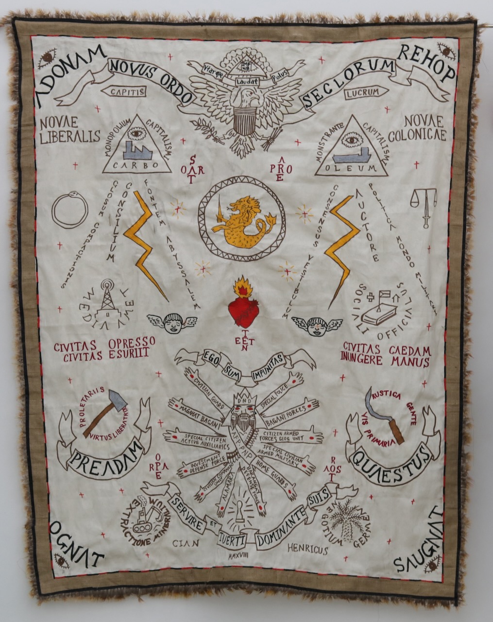
In the 16th-19th centuries maps were important in empire-building as visual representations of a colonial power’s expanding territory and wealth. The drawn borders distinguished the territories claimed by European colonisers and marked their control over local peoples and natural resources. Cian Dayrit revisits map-making in his contemporary art practice to trace the shape of imperialism in our post-colonial world, the web of power and money that controls resources, lands, and capital globally. Dayrit translates these new maps into embroidered tapestries or as drawings on colonial-era maps.
In Mapa ng Kapangyarihan at Gahom, (2018) Dayrit appropriates the imagery and language of local animist talismans or anting-anting to illustrate how the ”global north" – represented by the International Monetary Fund and developed countries that manage and support it – continues to exert power over the “global south” through policies that enable them to control and extract capital and resources from the developing world.

Subscribe and Stay Updated with us!
If you like to stay updated on the latest news about the collection, please enter your emai.